Bike Walk RVA’s interactive bikeways map
You could not ask for better bike-riding weather, and now you know where to go.
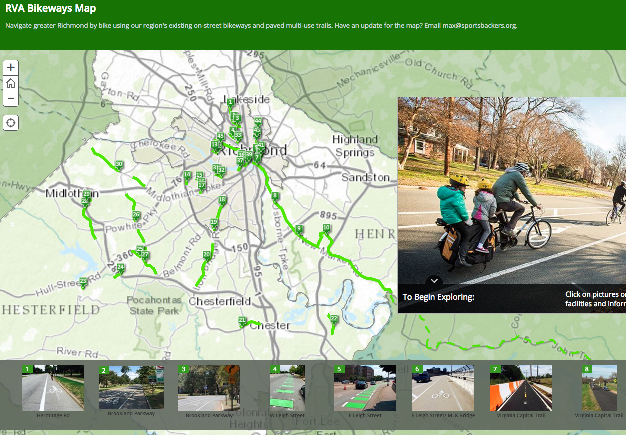
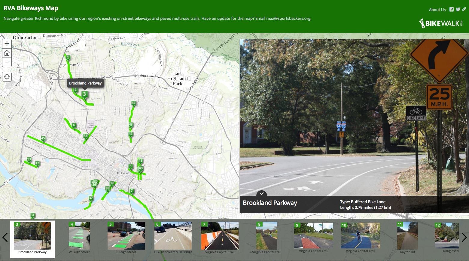
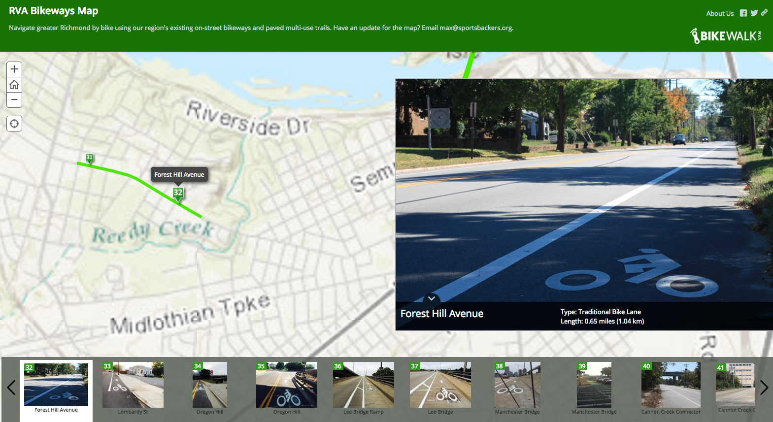
Bike Walk RVA has unveiled the amazing RVA Bikeways Map you see in the screen shot above. What makes it so amazing is that all those green lines and green boxes are bikeway, and by clicking on the box you get to see exactly what that spot looks like.
A network of on-street bikeways and paved multi-use paths is developing in greater Richmond. Some of these bikeways are brand new to the region, while some have been here for years. Bike Walk RVA (a program of Sports Backers) has created on online bikeway map of the region to help you identify where the bikeways are in your area, as well as what they look like. Each pin on the map shows an image of the bikeway, tells you what type it is (standard bike lane, paved multi-use trails, buffered bike lane, etc.), and how long it spans.
We still have a long way to go before we have a comfortable and connected network for all ages and abilities in our region, but progress is being made! We will update the map as new bikeways are completed. If know of something that is missing or have additional suggestions for improvement, email max@sportsbackers.org.
A couple examples of box clicking:
-
Recommend this
on Facebook -

Report an error
-

Subscribe to our
Weekly Digest

Richard Hayes
When Richard isn’t rounding up neighborhood news, he’s likely watching soccer or chasing down the latest and greatest craft beer.

There are no reader comments. Add yours.