Visit 1889 Richmond with interactive map
This is a great opportunity for residents to check out what their neighborhood looked like in 1889.
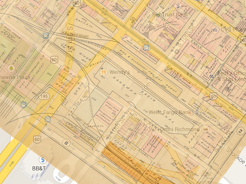
VCU Libraries has launched an interactive version of a Richmond map atlas from 1889, giving a look at how different the city was back then, and allows online visitors to compare it with the city today (via an integration with Google Maps). It also features a number of photos and illustrations from that era, as it links with VCU Libraries’ extensive collections of historical images of Richmond.
The map is from the “Atlas of the City of Richmond,” which was published in 1889 by the Philadelphia firm of George William Baist. The original Baist Atlas is made up of 20 panels, each 18 1/2 inches tall and 28 inches wide, mapping all areas of Richmond, including parts of Henrico and Chesterfield counties, as well part of as what was then the city of Manchester on Richmond’s Southside.
This is a great opportunity for residents to check out what their neighborhood looked like in 1889.
Image: VCU Libraries
-
Recommend this
on Facebook -

Report an error
-

Subscribe to our
Weekly Digest

Richard Hayes
When Richard isn’t rounding up neighborhood news, he’s likely watching soccer or chasing down the latest and greatest craft beer.

There are no reader comments. Add yours.