New wayfinding signs mark the first phase of ongoing project
You’ve seen ‘em, but what’s the larger implication? (There is always a larger implication!)
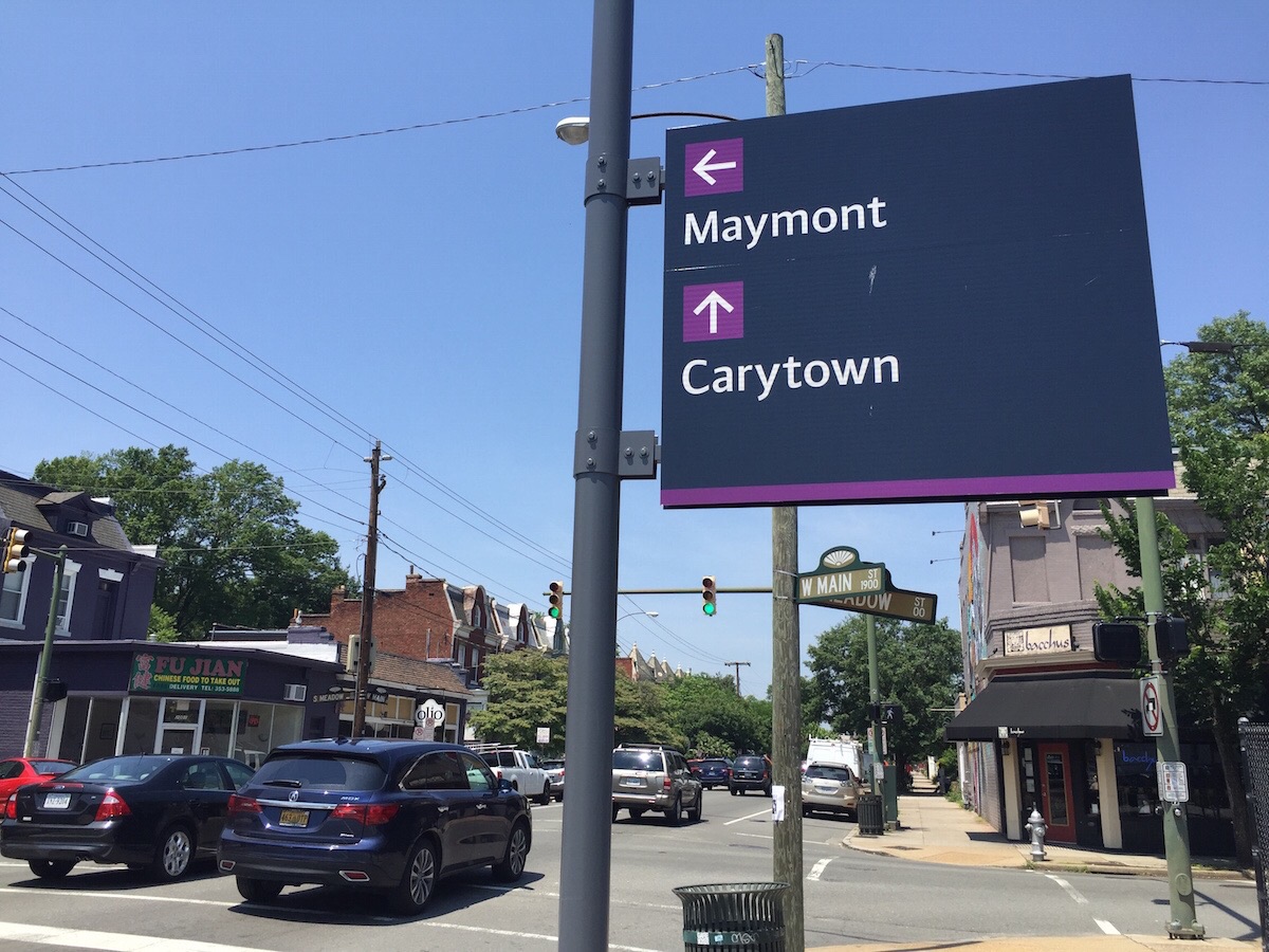
Quietly and without much fanfare, 74 large, almost monolithic signs have popped up along Richmond streets in recent months. The dark gray rectangles stand out on the occasionally crowded streetscape, and they have distinctive gray poles to match. Each sign contains a color-coded bullet point list of Richmond landmarks. And each sign has a stripe of color at the top and bottom.
Their mysterious purpose: wayfinding. Or as Mark Olinger, Richmond’s Director of Planning and Development Review, says, “[to] make it easier to get to your destination safely and quickly.” Olinger says the 74 installed signs are the first of a two-part update to the city’s wayfinding system intended to help visitors find the cultural institutions and landmarks.
Wayfinding systems use visual cues to help people navigate complex networks or environments. The new signs use different colors to denote different districts or neighborhoods:
- Downtown: Orange
- Monroe Park: Yellow
- James River area: Blue
- The Boulevard: Purple
The colored stripes at the top and bottom of a sign identify the district in which the sign is located, and the colored bullet points identify the district of the landmark listed. Naturally, there are also arrows directing drivers towards the listed landmarks.
Signs in the first phase are intended to target visitors in their cars as they exit highways and enter major streets, direct them towards popular landmarks, help them navigate the city’s sometimes-confusing mix of one-way and two-way streets safely, and get them to parking. Olinger expects the first phase to be complete by the end of June.
Signs in the second phase will provide more information for pedestrians, including maps and more detailed lists of the area’s amenities. Those signs may also incorporate some less traditional, more millennial things like QR codes and social media links. I’m crossing my fingers for an Oderus Urungus Snapchat filter. That process is scheduled to be complete by the end of 2017.
The contract for the project is $548,000, which includes fabrication and installation of the signs. Olinger says the signs are expected to last 10 to 20 years, but deterioration due to sun and weather exposure is inevitable.
The downtown area currently has two other wayfinding systems that Olinger estimates to be at least 10 to 20 years old. Signs from those systems will be removed during the Summer and Fall months.
Design of the signs was contracted to New York-based Two Twelve Projects, with Richmond-based architects Stockton Clay handling local design and site development.
-
Recommend this
on Facebook -

Report an error
-

Subscribe to our
Weekly Digest

Mike MacKenzie
Mike is an urban planning grad, housing policy specialist, and radio veteran.

There are 4 reader comments. Read them.