A bit of Westover Hills history for your wall
See what it is and what could have been.
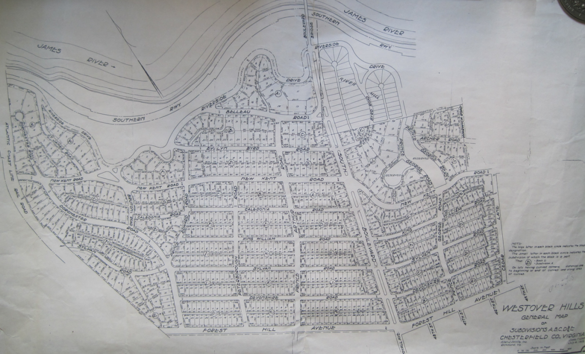
WHNA is making available prints of an original 1928 plat map of Westover Hills, acquired thanks to the generosity of an anonymous donor. The map details every street and lot from Cedar Lane to the Atlantic Coast Line Railroad (thus not including Westover Hills West), and shows some streets that were never built and names that were later changed and are now lost to history.
The high-quality prints come in the standard framing size of 22” x 28” – a size that also maintains the detail of the original 17” x 28” map. The prints will be $15 each for WHNA members, but $25 each for non-members. To order, just click here!
Prints ordered right away will be available for pick-up at taZa Coffee ‘n Creme on Saturday, December 19, from 10 a.m. to noon. If you’d like to arrange for pick-up at another time, contact John Coski at jmcoski1@gmail.com or 233-0705. (Sorry, but we aren’t able to mail them to you.)
Sale of the prints benefits the WHNA’s Community Involvement Fund (which has, in recent years, made donations to support infrastructure improvements for the Westover Hills Branch Library, Westover Hills Tot Lot, the Westover Hills Elementary School, and Patrick Henry Charter School, among other projects).
The picture at the top of the page is the original 1928 plat map, not the high-quality prints that you’ll receive.
-
Recommend this
on Facebook -

Report an error
-

Subscribe to our
Weekly Digest

Richard Hayes
When Richard isn’t rounding up neighborhood news, he’s likely watching soccer or chasing down the latest and greatest craft beer.

There is 1 reader comment. Read it.