UR’s interactive historical mapping project earns national distinction
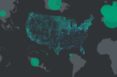
The American Panorama Project has thus far explored the migration of populations and formation of infrastructure from 1850 onward.
So long, RVA!
The American Panorama Project has thus far explored the migration of populations and formation of infrastructure from 1850 onward.
Through August 23, 2014, the Library of Virginia will host Mapping RVA: Where You Live Makes All the Difference, a traveling exhibition focused on charts, maps, housing, economics, inequality, and poverty. The multimedia exhibition of nine maps created by Brian Koziol, director of research and consulting services at Housing Opportunities Made Equal of Virginia, Inc. […]

The Richmond Marathon is this weekend and with it comes about a trillion road closings. If, like me, you’re a morning person, be prepared for delays, detours, and frustrations.

Ever seen a thing with 300 million other things on it?

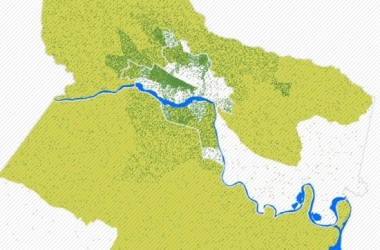
If you like a drink now and then, which plenty of people do, it stands to reason that you like being able to get yourself to a drink easily and quickly. Here’s a chartsandgraphs picture of the geography of drinking in RVA. Bottoms up!
![]()
![]()

Copyright © 2024 RVANews • Facebook, Twitter, Instagram, RSS • Search • Contact Us • Advertisers