Chesapeake Bay impact crater adds to sea level rise
Scientists say the sea is rising at a faster pace in the Chesapeake Bay due to a meteor that collided with the region 35 million years ago.

By Brian Compere | UMD Capital News Service
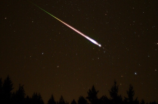
About 35 million years ago, a meteorite collided with the Earth near the current location of the mouth of the bay, where it transitions into the Atlantic Ocean. The impact left a crater more than 55 miles wide, setting events into to motion that eventually led to the formation of the bay about 3,000 years ago.
When the meteorite hit, it created a giant hole into which loose materials flowed. This replaced harder rock layers from before the impact with much softer, less compacted dirt, said Curt Smith, regional planner for Virginia’s Accomack-Northampton Planning District Commission.
Since then, this softer material has slowly compacted together, shifting downward. Because of this, the land near the crater is slowly sinking.
Land around the bay has been slowly sinking for millions of years, but nobody has determined exactly how much of this is because of the crater, said Ward Sanford, a United States Geological Survey hydrologist. Smith said the crater is definitely one reason this area is experiencing the fastest rates of relative sea level rise on the East Coast.
Relative sea-level rise, which takes both rising sea levels and sinking land into account, averaged 3.9 millimeters a year, according to USGS data collected from four stations in the southern Chesapeake Bay until 2006. The global average sea level rise is 1.8 millimeters a year, according to a USGS report released in December.
Another effect that can contribute to sea level rise is the withdrawal of underground water supplies. If the amount of groundwater decreases, the weight of rock layers above the groundwater compacts softer layers downward, Sanford said. This can amount to centimeters of change over decades.
About 80 percent of sinking land nationwide is caused by groundwater withdrawals, according to USGS data.
Smith said the crater also appears to have influenced path of the James River and other rivers near where they meet the outer rim of the crater.
The crater was discovered relatively recently. But many others came across hints of its presence long before geologists Scott Bruce, David Powars, and their colleagues helped piece together the hints to reveal the crater. Bruce and Powars wrote an article for Virginia Explorer in 2000 about the history of these accidental interactions with the crater.
In 1864, Union soldiers at Fort Monroe near the mouth of the James River drilled a 907-foot well that drew salty water from inside the crater. More wells were drilled and more studies of groundwater supplies and other subsurface characteristics were done over the next decades. But Powars, Bruce and their colleagues didn’t get close to the discovery until 1986.
“On a hot August night, Don Queen (USGS driller) and Jay Owens (SWCB assistant driller) extruded a section of core that resembled none other taken in Virginia,” Powars and Bruce wrote in the Virginia Explorer article. “The next day, in better daylight, Powers, Bruce and Steve Schindler puzzled over the atypical composition of the core. At one point, David Powars jokingly commented, ‘Wouldn’t it be cool if this was from a meteor impact?’ Everyone roared with laughter.”
Later, Powars got seismic data of the bay region from Texaco in 1993 that showed evidence of the crater, supporting the theory of a meteor impact.
Although hints of the crater had been discovered since as early as 1864, it wasn’t until the Texaco data was analyzed that the crater’s existence was definitively confirmed.
“Any time you come up with something new and they all think ‘how could you possibly know?’ they laugh at you,” Powars said. “When I got the eureka point, once I had figured that out, I knew I could defend it against anybody.”
Photo by: Ed Sweeney
-
Recommend this
on Facebook -

Report an error
-

Subscribe to our
Weekly Digest


There are no reader comments. Add yours.